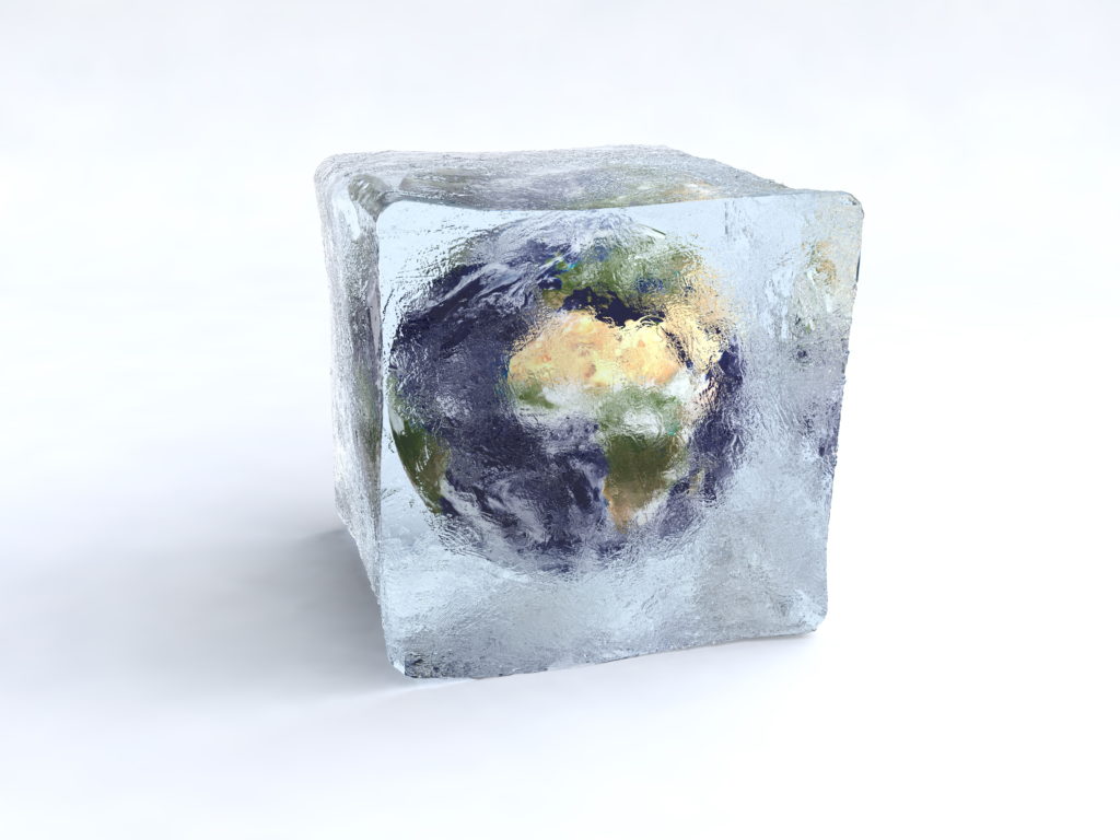
At the end of the last ice age, the earth was a very different place. Most of North America and Western Europe were covered in a glacial ice sheet. Sea levels were much lower and the continents were unlike they are today. The story of how prehistoric earth shifted to its modern form has long been the focus of scientific study.
For most of the 20th-century geologists believed the transition out of the ice age was a gradual process. New evidence, however, is revealing that prehistoric earth faced far more violent conditions. The Younger Dryas period has been documented as one of the most turbulent stages in prehistory. Now the evidence of a planet-shaking flood during this time is mounting.
One of the biggest mysteries is what caused the prehistoric North American ice sheet to disappear. In this article, we’ll outline new scientific discussions on earth’s prehistory and the Younger Dryas flood.
The prehistoric earth & end of the ice age
It’s hard to picture that the earth was in a full glacial ice age just 12 000 years ago. At the height of this earth period, all of Canada, Northern US, Western Europe, the Himalayas, the Rockies, and the Andes were all covered in an ice sheet. Sea levels were 400ft lower that exposed millions of miles of land today covered in sea.
A total of about 7 million cubic meters of glacial ice-covered prehistoric earth. A large portion of that lay over Canada and north of the US.
The huge problem facing scientists is to explain where all that mid planet ice went. Initially, it was thought it disappeared over tens of thousands of years in a slow gradual melt. However, new evidence has revealed that the collapse of prehistoric glaciers occurred in as little as 4000 years.
Studies now reveal that Western Canada was ice-free some 14 000 years ago. This places the melt of the Cordilleran Ice-Sheet to a time earlier than the Younger Dryas. It doesn’t explain how the much, much larger Laurentide Ice sheet vanished in a geological blink of an eye.
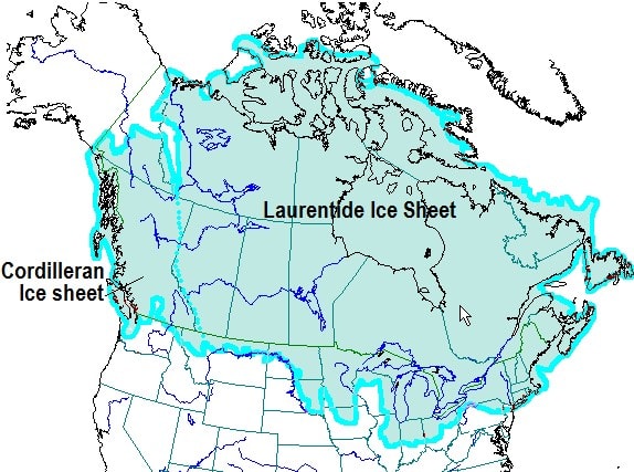
The North American ice sheets of prehistoric earth.
The gradual ice-dam burst model
The most accepted theory of how the North American glaciers melted is the ice-dam burst theory. It describes gradual and repeated bursting of glacial lakes in North America that eventually lead to the loss of the North American Icecap.
‘Jökulhlaups’ is the name given to glacial ice dams that burst. This process is well documented in Iceland, when volcanic activity under glaciers causes rapid melting of ice, causing ice dam bursts. Many are still observable today.
One initial problem with the hypothetical Ice-dam burst theory is that it has never been seen on a scale of an ice age. The largest documented ice dam burst is a thousand times smaller than the ice present at the end of the last ice age.
The Younger Dryas flood theory emerges
The debate on what caused the prehistoric ice sheet melt has raged since the early 1900’s. One geologist named J Harlen Bretz proposed a catastrophic single flood that wiped the majority of glacial ice.
His theory came from studying the scarred landscapes of North America. The geological patterns, in his opinion, showed an incredibly large flood of prehistory which occurred due to the ice sheet melted suddenly.
The flood’s trail of destruction can still be seen throughout the geology of North America.
To his colleagues, Bretz’s idea was dismissed as religious heresy with no geologists taking serious notice of his claims. The main criticisms were that his theory was held in observations of geology.
However, he never attempted to explain the cause of the catastrophic event to melt the ice so rapidly. He was heavily dismissed on this basis.
The Great Missoula Ice-Dam Paradox
During the 20th century, Bretz painstakingly built evidence on the ground with little access to helicopter or satellite technology. He studied the North American landscape to gather data on the ending of the ice age.
Data was slow, as it was incredibly hard to observe large geological land features without an expensive plane. The ice-dam burst model remained and still remains most accepted.
Despite this, Bretz continued to build evidence for the single flood he proposed. Suspicions and discussions began to grow in the geological community that perhaps Bretz was on to something.
One of the turning points centered on the glacial Lake Missoula. The size of the geological scar on the land was so large that the geologist community estimated it to burst as much as seven times.
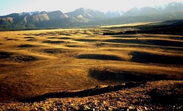
It occurred during the last Ice Age 15,000 to 13,000 years ago. A great blanket of ice called the Cordilleran Ice Sheet covered most of Canadian North America, dipping down into parts of the U.S.
As the ice melted, it formed lakes like Lake Missoula where the water was held in by a 2,000-foot wall of ice. The area where the city of Missoula now stands was then under 950 feet of water.
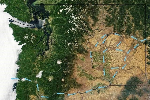
Thousands of square miles of vegetation were completely washed away as well as intense amounts of soil and sediment. As a result, the area known as the ‘channeled scablands’ in Eastern Washington.
However, as research continued it was revealed the volume of water to mark the land of the Missoula Lakes had to be increased to 80 Ice Dam bursts.
Despite a relatively illogical number, this theory remains accepted today.
In 1965, the International Association for Quaternary Research organized a field trip to Bretz’s proposed flood sites. This included the Columbia Basin, an area that featured largely in Bretz’s proposal for catastrophic flooding.
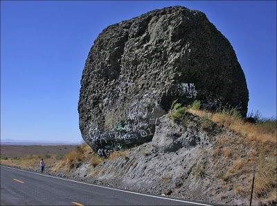
Giant boulder in Eastern Washington carried by ice during the Missoula Flood. Its size compared with man on road at left.
J Harlen Bretz was awarded the Penrose Medal in 1979 for outstanding contributions to the geological society.
He inspired a generation of researchers to have another look at evidence left by end of the ice age.
Younger Dryas flood evidence on the North American landscape
Today, we are blessed with technology that allows swift recording of geological land features.
Across North America lie Bretz’s noted scars of a huge body of water that flooded prehistoric earth.
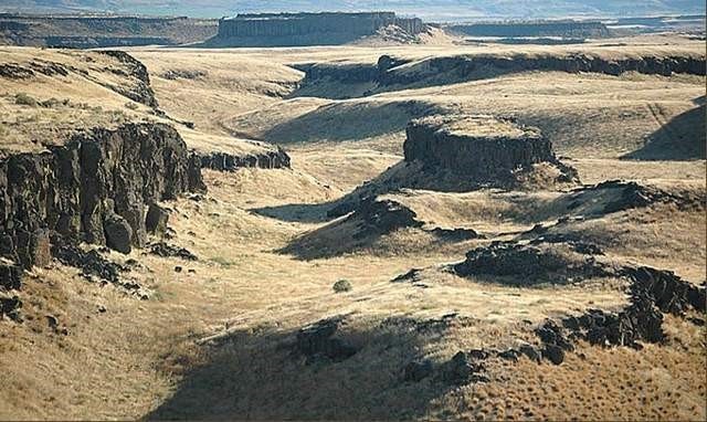
Drumheller Channels, Wash. These were carved out by Missoula Flood waters. Photo: Tom Foster.
Giant ripples averaging 24 feet high in Washington Scablands created by Missoula Flood (also called Spokane Flood) were up to 360 feet between crests.
However, other scientific arguments support the idea of a single flood.
These include:
1) The Energy Paradox
Originally the ice-sheets were thought to have melted over tens of thousands of years in a very slow process. It is now clear that the ice was completely gone in as little as a few thousand years.
In order to remove such a large body of ice during this time period, an enormous amount of energy is required. This suggests that a catastrophic event needed to intervene in order for the ice to disappear. Such an event would fit with a single flood due to a large amount of energy dispersed.
2) The Younger Dryas Prehistoric Climate Change
A period of drastic climate change also occurred as the prehistoric ice age was ending. Geologists classify this period as the Younger Dryas. It’s named after a flower found in Europe that flourished in the ice age period.
From 19 000 years, the Earth began to warm. This continued until around 12000 years when it was violently thrown back into an ice age for 1100 years
The violent weather patterns of the Younger Dryas were discovered through the Greenland Ice Cores in the 1990s.
With temperature changes of up to 15 degrees in as little as a few years, scientists began to see that our prehistory was more catastrophic than first thought.
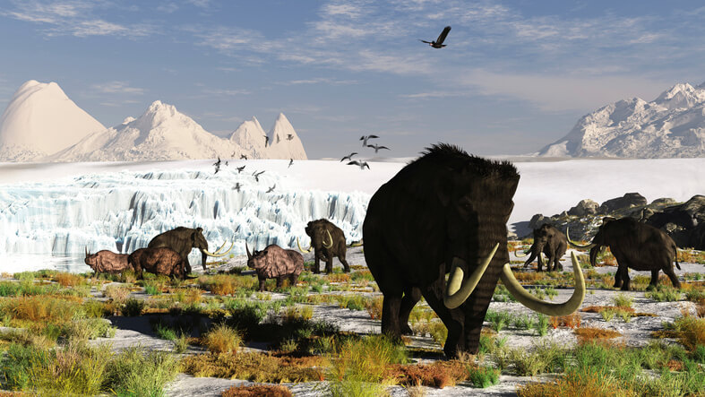
3) The North American Megafauna Mass Extinction
During the Younger Dryas period there was an unexplained extinction of 75% of the North American megafauna.
Scientists have been gathering evidence of events that suggest a violent extinction episode wiping the Woolly mammoths, Sabertooth tiger, and other large mammals from the planet.
4)The disappearance of the Clovis People
In the same time period archaeologists have also noted the sudden the disappearance of the Clovis people. A long established and complex ancient culture was seemingly wiped from the planet in an instance.
Conclusion:
Scientific discussion continues over what caused ice sheets of North America to disappear. Evidence has been mounting for over a century and has tipped the possibility of a single catastrophic flooding event could have pre-empted the end of the ice age.
Each of these lines of inquiry show suggests a Younger Dryas flood was responsible.
Do you think the Ice-Dam Burst theory explains the loss of the North American Ice Sheet?
Do the geological scars across North America suggest a Younger Dryas flood?
If proven, it could be one of the biggest breakthroughs in discovering the Human Origin Story.
References:
- http://science.sciencemag.org/content/358/6364/781
- http://sp.lyellcollection.org/content/143/1/171
- https://pubs.er.usgs.gov/publication/70041337